UN
8 Stonecrop
£ 370,000
Description
We don't have a Description for this property.
- Bedrooms
- 4
- Bathrooms
- 0
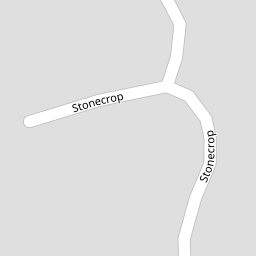

Leaflet © OpenStreetMap contributors
The heatmap indicates the level of crime in the area. The color of the heatmap indicates the crime severity and recency.
Metrics Year-on-Year
- Average area value
- 375,239.00 £Decreased by 6.08 %
- Average area rental value
- 1,067.00 £/moDecreased by 13.74 %
- Est rental Yield
- 3.41 %Decreased by 8.33 %
- Crime Rate
- 3.00 %Unchanged by 0.00 %
from 399,544.00 £
from 1,237.00 £/mo
from 3.72 %
from 3.00 %
Nearby Schools
| Name | Type | Ofsted | Distance |
|---|---|---|---|
| Childwall Church Of England Primary School | Voluntary Aided School | Outstanding | 0.52 KM |
| Liverpool Hope University | Higher Education Institutions | 0.75 KM | |
| Abbot'S Lea School | Community Special School | Outstanding | 0.81 KM |
| Carleton House Preparartory School | Other Independent School | 0.81 KM | |
| St Francis Xavier'S College | Academy Converter | Requires improvement | 0.90 KM |
Images
Nearby Streets
| Name | Average Price | Average Sqft | Distance |
|---|---|---|---|
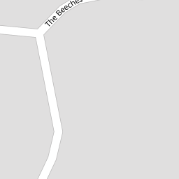
| The Beeches | £ 624,983 | 0 | 0.00 KM |
| Penfold Close | £ 700,000 | 0 | 0.00 KM |
| Porlock Avenue | £ 537,500 | 0 | 0.00 KM |
| Beechfield Road | £ 617,000 | 0 | 0.00 KM |
| The Hollies | £ 472,500 | 0 | 0.00 KM |
Nearby Transport
| Name | NLC | TLC | Distance |
|---|---|---|---|
| Broad Green | 2240 | BGE | 2.34 KM |
| West Allerton | 2266 | WSA | 2.88 KM |
| Liverpool South Parkway | 9709 | LPY | 3.19 KM |
| Mossley Hill | 2171 | MSH | 3.20 KM |
| Cressington | 2225 | CSG | 4.09 KM |
Nearby Listings
| Address | Price | Type | Score | Distance |
|---|---|---|---|---|
| The Beeches, Calderstones, Liverpool. | £ 625,000 | BUY | 7 / 10 | 0.14 KM |
| Woolton Road, Childwall, Liverpool, Merseyside, L16 | £ 450,000 | BUY | Unknown | 0.19 KM |
| Hornby Lane, Allerton, L18 | £ 450,000 | BUY | 6 / 10 | 0.29 KM |
| Hornby Lane, Liverpool, Merseyside, L18 | £ 450,000 | BUY | Unknown | 0.29 KM |
| Druids Park, Liverpool, L18 | £ 595,000 | BUY | 7 / 10 | 0.31 KM |
Nearby Properties
| Address | Price | Distance |
|---|---|---|
| 8 Stonecrop | £ 370,000 | 0.00 KM |
| 3 Stonecrop | £ 475,000 | 0.00 KM |
| 29 Stonecrop | £ 325,000 | 0.00 KM |
| 4 Stonecrop | £ 166,000 | 0.00 KM |
| 23 Stonecrop | £ 585,000 | 0.00 KM |